KO NGĀ PĀ
Ko Te Awaroa he wāhi rongonui hei nohoanga. Kei konei he kaimoana me he taepu mō te ahuwhenua. Tokomaha ngā tāngata i hiahia ki te noho. Arā, he maha ngā pakanga ki konei, ā, i hangaia he pā maha e ngā iwi Māori, kia noho ai rātou ki runga ki te whenua. I te taenga mai o te Pākeha ka mau te rongo. Ka noho tonu ai a Ngāti Whātua ināianei. Kei hea ināianei aua pā Māori?
FORTIFIED VILLAGE
Te Awaroa (Helensville) was a popular place to live due to its availability of seafood and its good soil for agriculture. Many people wanted to live here and there were many battles for the land. They had numerous fortified villages to defend the land. Ngāti Whātua were here when Europeans arrived, and peace remained. Ngāti Whātua also remains. Europeans had no need for fortifications here, but what happened to the Māori pā?
The good soils and the abundant food supplied by the Kaipara River made Te Awaroa a good place to live. To ensure their place, Māori needed good fortifications to retreat to. Stop and look around at the hilly side. Try to imagine that there are no buildings. What you see are the pa sites of Te Awaroa.
Just North of Te Awaroa was the Kaikai pa – now known as Mount Rex. On the northern side of Te Awaroa stood the Otamateanui Pa, named after Tamatea-Pokai Whenua, who arrived on the Tākitimu canoe with the great migration and who went on to explore the land. Most of the long-time residents of Te Awaroa will have memories of sliding down the lower parts of Otamateanui on their pieces of cardboard on show days. It overlooks the current A & P Showgrounds, the river, and the railway. It was a good defendable site. Tumupakihi held this land.
Te Horo was another of Te Awaroa’s pa sites. This is above where the river almost meets itself, above where the “Ngā Tapuwae o mua” trail sign stands. It had an embankment all around it and was very defendable. Some of the dug-out defense work can still be seen.
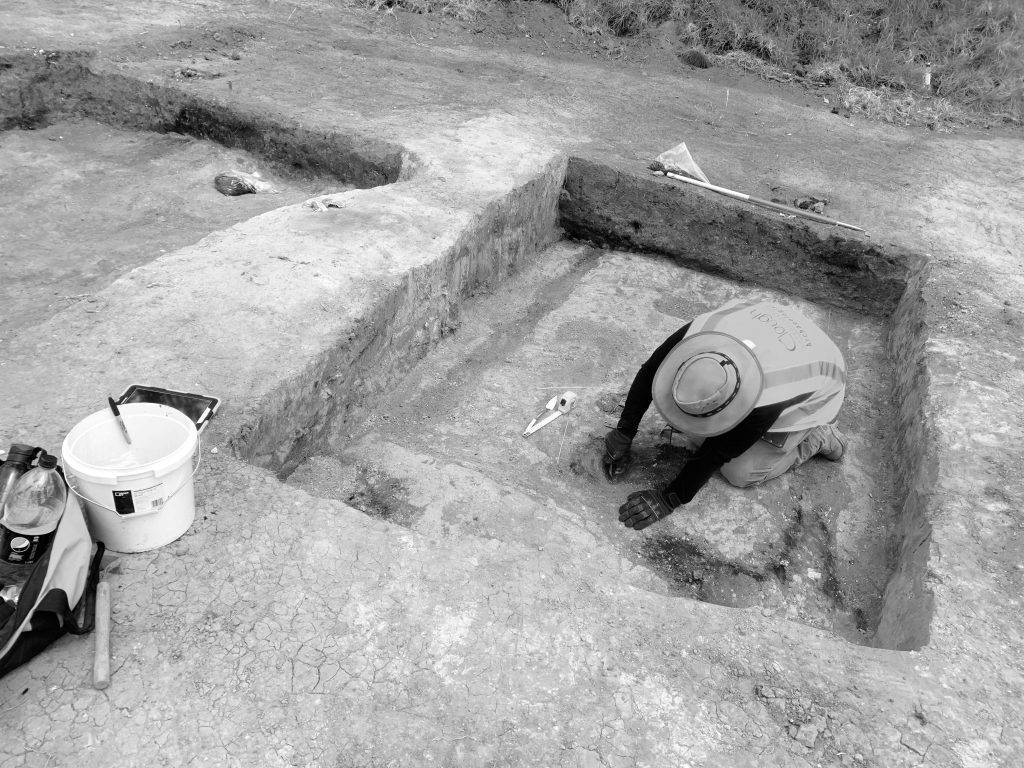
In 2019 a team of archeologists from Auckland University excavated the remains of the pā, once the finished documenting this, a new housing development was built over it.
The third pa site, Te Makiri, still retains its name. This is the large pa where a house of the same name now stands. Makawe, the high-chieftainess of Te Taou, held Te Makiri. Te Taou are recognised as the presiding iwi of Te Awaroa.
It is mentioned in newspapers from the past that Māori were very reluctant to sell the land of Te Awaroa but it wasn’t long after their arrival that John McLeod owned the North (including Otamateanui), Isaac McLeod owned the South (including Te Horo) and Judge Rogan owned Te Makiri.
The sale of the land ensured that the Pakeha would stay and so ensure ongoing peace. The loss of such important sites was a high price to pay though and one is left wondering what consequences may have been alluded to if the sales did not go ahead. It should be remembered that the Thompson murders had occurred only a short time before and Europeans were still a little edgy.
John McLeod purchased his land before the Court house was ready but a later investigation legitamised the purchase. The wording was interesting however, as the tribe assented to “Otamatea for John McLeod to live on, as a Pakeha for that place”. 300 acres is a decent sized place to live. Needless to say, its kauri groves were gone before John McLeod, which was less than six years after he arrived.